On Canada’s western edge, huge volumes of rainwater and meltwater flow off the land into the ocean. But a decade ago, most areas had little data available about the makeup of that runoff or its impact on marine ecosystems.
That void caught the attention of the Hakai Institute: a B.C.-based organization dedicated to advancing the science of coastal margins where land meets sea. So, in 2013, researchers set out to begin addressing the data gaps.
What they found were striking contrasts. “The B.C. coast is a story of extremes,” says Ian Giesbrecht, an ecosystem scientist at the Hakai Institute.
Exploring the linkages between B.C.’s land and sea
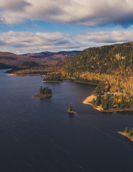
Initially, the researchers began monitoring watersheds on Hecate and Calvert Islands, north of Vancouver Island. Vast amounts of rain fall here — enough to actually stunt the growth of trees and create bog forests. As the rainwater filters through wetlands and wooded areas, it picks up all kinds of terrestrial organic matter.

A phytoplankton bloom in the Salish Sea. Phytoplankton blooms form in nutrient depleted waters. Image source: NASA.
In fact, monthly samples from 2013 to 2019 revealed one of the highest levels of dissolved organic carbon export in the world moving from land to ocean, fueling marine food webs. In contrast, the fresh water contained so little inorganic nutrients like nitrogen and phosphorus that it actually diluted levels in the sea.
Next, the Hakai investigators turned their attention to the mainland coast between Rivers Inlet and Bute Inlet. The extensive glaciers found in these rugged fjordlands feed lakes and rivers. As a result, Giesbrecht and his team found a radically different kind of runoff, with comparatively high concentrations of minerals scraped from the bedrock, and very little organic material.

Water flows from the ice fields to the ocean. Image source: The Hakai Institute.
Now, the team is working with marine scientists to better understand how those freshwater inflows impact the sea. “It’s really fascinating and fun to discover more about those linkages,” says Giesbrecht. “I hope that it’s a growing trend to tie the two together in a more holistic way.”
Pooling data for deeper insights
Collaborations are an important part of how the Hakai Institute operates, Giesbrecht explains. For example, each dataset required contributions from a range of scientists, multiple analytical laboratories, and a highly motivated team of skilled technicians. Research plans and study findings were also discussed and shared with First Nations, with potential applications for watershed stewardship.
Open science is another core value, which made sharing the results on DataStream’s platform a natural choice. “[We] want to make the data accessible to as many people as possible,” says Giesbrecht. “That’s why we were really excited when DataStream announced that they were launching a Pacific version of the data-sharing tool.”

The extensive glaciers around Rivers Inlet and Bute Inlet feed lakes and rivers. Image source: Ian Giesbrecht/Hakai Institute.
The task of uploading years of data was tackled by Hakai Institute field technician Isabelle Desmarais, and it proved much simpler than she anticipated. DataStream provided a detailed template to ensure all the data on the site uses the same standardized format. The DataStream team also provided plenty of support.
“Everybody there has been extremely helpful and responsive,” Desmarais says. “They actually made it super easy.”
Giesbrecht is pleased to see that the pooled data has already been put to use in Water Rangers’ 2025 Watersheds Reports on the state of freshwater in Canada. “That’s a nice example of the kind of really large-scale assessment that can be done by pulling together data from many different sources,” he says.
View the dataset: https://doi.org/10.25976/yvt5-dv52.